Jeremy Norman’s
HistoryofInformation.com Exploring the History of Information and Media through Timelines
Jeremy Norman’s

A: Paris, Île-de-France, France
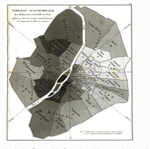
In 1834 French economist, statistician and demographer Louis-François Benoiston de Châteauneuf, as head of a French commission, issued from Paris Rapport sur la marche et les effets du choléra-morbus dans Paris et les communes rurales du département de la Seine / par la commission nommée, avec l'approbation de M. le ministre du commerce et des travaux publics, par MM. les préfets de la Seine et de police ; année 1832. This work contained one of the earliest applications of spatial analysis in epidemiology—an early thematic map by geographer and cartographer Charles Picquet, in which the 48 districts of Paris were represented by color gradient according to the percentage of deaths from cholera per 1000 inhabitants.